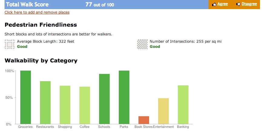
Shall we talk about measures of pedestrian friendliness? Over the years, WalkScore.com has evolved their methodology from a very elementary to much more sophisticated as you can see in the new WalkScore Beta that was introduced in January 2011. The new WalkScore Street Smart Score calculates actual walking paths to a list of destinations rather than the old way which simply drew a radius without taking into account actual walking paths, it categorizes all of these destinations by type, giving a higher weighting to those more closely correlated with walking. The number of destinations per category also matters – showing the depth of choices in that category (restaurants for example), something highly related to walkability. Perhaps most importantly it looks at the underlying road network to compute the number of intersections per square mile and average block length. These two measures are great quantitative indicators of walkability.
I can relate to this. In my standard walk to and from work, the portion I dread the most is the portion with no intersections or blocks for a lengthy distance – including a completely boring bridge crossing an interstate which I will post about another day.
See a screenshot from the new Street Smart Score with block length and intersection density data based on my home address in Detroit: